Kuala Lumpur-Seremban Highway (KLS)
Overview
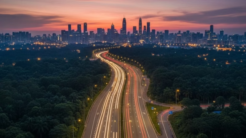
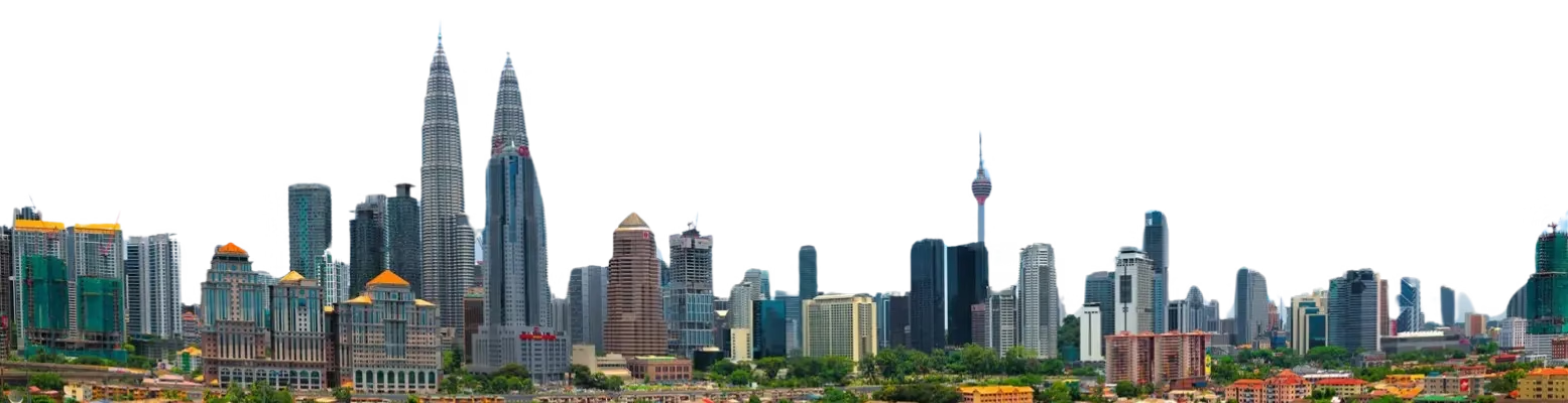
The Kuala Lumpur–Seremban Expressway Highway is a major artery in Malaysia’s road network, connecting the capital city of Kuala Lumpur with Seremban, the capital of Negeri Sembilan. Spanning approximately 63 km, this expressway was completed in 1982 and is operated by PLUS Malaysia Berhad (PMB). It plays a critical role in facilitating trade, logistics, and passenger travel between the Klang Valley and southern Malaysia, serving as part of the larger North–South Expressway network. The route not only supports commercial transport but also serves daily commuters and tourists traveling to Negeri Sembilan and beyond.
Route Overview
The expressway runs primarily in a north–south direction, forming a key section of the North–South Expressway Southern Route, designated as E2. It starts from Jalan Duta in Kuala Lumpur and ends in Seremban, linking seamlessly to the Seremban–Port Dickson Highway. Along the way, it passes through the outskirts of Kuala Lumpur, the suburban town of Bangi, and enters Negeri Sembilan, covering Selangor and Negeri Sembilan states.
Key Cities and Exits
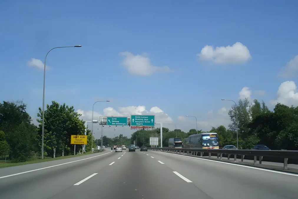
The expressway serves several key towns and interchanges, providing access to local destinations and other highways:
- Jalan Duta Interchange (KL) – Entry point from Kuala Lumpur city.
- Bangi Exit – Access to Universiti Kebangsaan Malaysia (UKM) and surrounding townships.
- Nilai Exit – Connecting to the Nilai Industrial Park and Nilai Premier Outlet.
- Port Dickson Link – Junction leading to coastal areas of Negeri Sembilan.
- Seremban Interchange – Connection to local roads and town center.
This sequence of exits ensures both local and long-distance connectivity.
Kuala Lumpur-Seremban Highway (KLS) Scenic Highlights
Travelers along the Kuala Lumpur–Seremban Expressway Highway enjoy a mix of urban and natural scenery. Key highlights include:
- Rolling hills and plantations near Bangi and Nilai.
- Views of the Titiwangsa mountain range in the distance.
- Lush greenery and tropical forests along stretches outside the Klang Valley.
For photography enthusiasts, early morning drives offer scenic sunrises over the plantations.
Rest & Service Areas (R&R)
The expressway offers several well-equipped rest stops for travelers:
- Nilai R&R: Petrol stations, food courts, ATMs, prayer rooms, and toilets.
- Seremban R&R: Offers local cuisine, convenience stores, and fuel services.
These R&R areas provide essential amenities and a convenient break for long-distance drivers.
Toll Information
The Kuala Lumpur–Seremban Expressway uses a closed toll system, where charges are calculated based on entry and exit points. Accepted payment methods include:
- Touch ‘n Go cards
- SmartTAG
- RFID
Sample Toll Rates:
- Kuala Lumpur to Nilai: RM 5.40 (class 1 vehicles)
- Kuala Lumpur to Seremban: RM 7.80 (class 1 vehicles)
Toll rates may vary depending on vehicle class and updates from PLUS Malaysia Berhad.
Safety & Facilities
The expressway is well-maintained with several safety measures:
- PLUSRonda patrol services available 24/7 for emergencies.
- Standard speed limit: 110 km/h for passenger vehicles.
- Multiple lanes in both directions, with dedicated emergency lanes.
- Emergency hotlines available at R&R areas and along the route.
Drivers are encouraged to follow safety protocols and remain vigilant, especially during peak traffic hours.
Useful Apps & Resources
Travelers can use the following apps and resources for real-time updates:
- PLUS Mobile App – Toll payments and service area info.
- Waze & Google Maps – Live traffic monitoring.
- MyTRAFFIC & JPJ – Road alerts and updates.
- PLUS Helpline – +603-7841 3333
These tools help optimize travel planning and avoid congestion.
Travel Tips
- Travel early morning or late evening to avoid peak traffic near Kuala Lumpur.
- Maintain lane discipline; use the left lane for slower vehicles.
- Plan fuel stops at R&R areas, especially during festive seasons.
- Observe speed limits and highway etiquette to ensure a safe journey.
Connecting Expressways
The expressway links to several major routes, enhancing regional connectivity:
- North–South Expressway Southern Route (E2) – Extends north to Kuala Lumpur and south to Johor Bahru.
- Seremban–Port Dickson Highway (E29) – Provides access to Port Dickson coast.
- Kajang–Seremban Highway – Local connectivity to suburban towns.
Kuala Lumpur-Seremban Highway (KLS)
| Feature | Details |
|---|---|
| Expressway Name | Kuala Lumpur–Seremban Expressway |
| Code | E2 |
| Total Length | 63 km |
| Operator | PLUS Malaysia Berhad |
| Start & End Points | Jalan Duta, KL – Seremban, Negeri Sembilan |
| States Covered | Selangor, Negeri Sembilan |
| Average Speed Limit | 110 km/h |
| Toll Type | Closed System |
Conclusion
The Kuala Lumpur–Seremban Expressway is a vital corridor in Malaysia’s transport network, supporting commerce, tourism, and daily commuting. Its seamless connectivity, well-maintained facilities, and strategic links to other highways make it an essential route for anyone traveling between Kuala Lumpur and Negeri Sembilan. Whether for business or leisure, the expressway ensures a smooth and efficient journey, contributing to the country’s economic growth and regional accessibility.
| Road Name | Road Short Name | Code | Main Route |
|---|---|---|---|
| North–South Expressway (PLUS) | North–South Expressway | PLUS / E1, E2 | Bukit Kayu Hitam – Johor Bahru |
| North–South Expressway Central Link | ELITE Expressway | E6 | Shah Alam – Nilai North |
| New Klang Valley Expressway | NKVE | E1 | Kuala Lumpur – Klang |
| Federal Highway | Federal Highway | E5 | Kuala Lumpur – Klang |
| Damansara–Puchong Expressway | LDP | E11 | Damansara – Puchong |
| Shah Alam Expressway | KESAS | E5 | Sri Petaling – Pandamaran |
| New Pantai Expressway | NPE | E10 | Subang – Bangsar |
| Maju Expressway | MEX | E20 | Kuala Lumpur – Putrajaya |
| Kajang Dispersal Link | SILK | E18 | Kajang – Semenyih |
| Kajang–Seremban Highway | LEKAS | E21 | Kajang – Seremban |
| South Klang Valley Expressway | SKVE | E26 | Pulau Indah – Kajang |
| Guthrie Corridor Expressway | GCE | E35 | Shah Alam – Rawang |
| Kuala Lumpur–Karak Expressway | KLK | E8 | Gombak – Karak |
| East Coast Expressway Phase 1 | LPT1 | E8 | Karak – Kuantan |
| East Coast Expressway Phase 2 | LPT2 | E8 | Kuantan – Kuala Nerus |
| Butterworth–Kulim Expressway | BKE | E15 | Butterworth – Kulim |
| Penang Bridge | Penang Bridge | E36 | Gelugor – Perai |
| Sultan Abdul Halim Muadzam Shah Bridge | Second Penang Bridge | E28 | Batu Maung – Batu Kawan |
| Johor Bahru Eastern Dispersal Link | EDL | E14 | Pandan – CIQ Johor |
| Senai–Desaru Expressway | SDE | E22 | Senai – Desaru |
| Second Link Expressway | Linkedua | E3 | Senai – Tuas (Singapore) |
| Kuala Lumpur–Seremban Expressway | KL–Seremban | E37 | Kuala Lumpur – Seremban |
| Cheras–Kajang Expressway | Grand Saga | E7 | Cheras – Kajang |
| Kuala Lumpur–Putrajaya Expressway | MEX | E20 | KL – Putrajaya – KLIA |
| West Coast Expressway | WCE | E32 | Taiping – Banting |
| Central Spine Road | CSR | – | Bentong – Kuala Krai |
| Federal Route 1 | Federal Route 1 | FT1 | Bukit Kayu Hitam – Johor Bahru |
| Federal Route 2 | Federal Route 2 | FT2 | Port Klang – Kuantan |
| Federal Route 3 | Federal Route 3 | FT3 | Johor Bahru – Rantau Panjang |
| Federal Route 4 | Federal Route 4 | FT4 | Gerik – Jeli |
| Federal Route 5 | Federal Route 5 | FT5 | Ipoh – Johor Bahru |
| Federal Route 8 | Federal Route 8 | FT8 | Kuala Lumpur – Kota Bharu |
| Federal Route 9 | Federal Route 9 | FT9 | Karak – Tampin |
| Federal Route 10 | Federal Route 10 | FT10 | Temerloh – Gemas |
| Federal Route 24 | Federal Route 24 | FT24 | Muar – Yong Peng |
| Federal Route 50 | Federal Route 50 | FT50 | Batu Pahat – Kluang – Jemaluang |
| Federal Route 51 | Federal Route 51 | FT51 | Melaka City – Alor Gajah |
| Federal Route 54 | Federal Route 54 | FT54 | Kuala Lumpur – Kuala Selangor |
| Federal Route 76 | Federal Route 76 | FT76 | Kuala Kangsar – Baling – Kulim |
| Federal Route 67 | Federal Route 67 | FT67 | Sungai Petani – Kuala Ketil |
| Pan Borneo Highway (Sabah) | Pan Borneo Sabah | AH150 / PBHS | Kota Kinabalu – Tawau |
| Kimanis–Keningau Highway | Kimanis–Keningau Road | – | Kimanis – Keningau |
| Kota Belud–Ranau Road | Kota Belud–Ranau | – | Coastal – Interior link |
| Pan Borneo Highway (Sarawak) | Pan Borneo Sarawak | AH150 / PBHS | Telok Melano – Miri |
| Kuching–Serian Road | Kuching–Serian | – | Kuching – Serian |
| Bintulu–Miri Coastal Road | Bintulu–Miri Coastal | – | Bintulu – Miri |
| Kota Bharu–Kuala Krai Expressway | KBKK Expressway | KBKK | Kota Bharu – Kuala Krai |
| Pan Borneo Highway (Overall) | Pan Borneo Highway | PBH | Across Sabah & Sarawak |


Comments are closed.