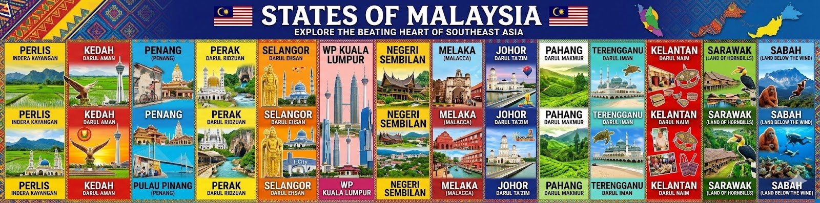
Penang Bridge: The Federal Route 2
Overview
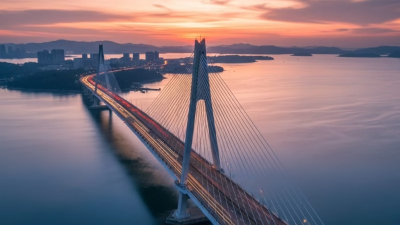
The Penang Bridge is one of Malaysia’s most iconic roadways, connecting the island of Penang to the mainland state of Seberang Perai. Spanning 13.5 km, it is the longest bridge in Southeast Asia upon completion in 1985. Operated by the PLUS Malaysia Berhad, the bridge plays a vital role in Malaysia’s transport network, facilitating trade, tourism, and daily commuting between Penang Island and the mainland. It is an essential artery for economic activity, linking industrial zones, ports, and urban centers.
Route Overview
The Penang Bridge runs in a north–south direction, linking Bayan Lepas on Penang Island to Perai on the mainland. Known officially as Federal Route 2, the bridge passes over the Penang Strait, providing motorists with uninterrupted connectivity between the island’s airport, industrial parks, and major towns on the mainland. Key milestones along the route include Bayan Lepas Free Industrial Zone, Prai Industrial Estate, and Butterworth.
Key Cities and Exits
Major interchanges along the Penang Bridge include:
- Bayan Lepas Interchange – provides access to Penang International Airport and Free Industrial Zone.
- Juru Interchange – connects to North–South Expressway (E1).
- Perai Interchange – links to industrial and commercial centers.
These exits allow travelers to reach important destinations efficiently, making the bridge a vital hub for commuters and commercial vehicles alike.
Scenic Highlights
The Penang Bridge offers breathtaking views of the Penang Strait and the surrounding coastline. On clear days, travelers can see Penang Island’s hills, Butterworth town, and maritime vessels in the strait. The bridge also provides a unique vantage point for sunrise and sunset photography, making it popular among local photographers and tourists.
Rest & Service Areas (R&R)
While the Penang Bridge itself does not have rest stops on the bridge, nearby R&R facilities on the mainland are accessible via connecting highways:
- Juru R&R – food courts, petrol stations, ATMs, and prayer rooms.
- Bukit Mertajam R&R – convenient for long-distance travelers heading south.
Drivers are advised to plan refueling and restroom breaks before crossing the bridge to ensure a smooth journey.
Toll Information
The Penang Bridge operates an open toll system, with payment collected at the Plaza Tol Penang Bridge on the mainland side. Accepted payment methods include:
- Touch ‘n Go cards
- SmartTAG electronic toll collection
- RFID payment systems
Sample toll rates:
- Cars (Class 1) – RM7.00 per crossing
- Motorcycles (Class 2) – RM2.00 per crossing
Rates are subject to change and should be checked on the official Penang Bridge website before traveling.
Safety & Facilities
The Penang Bridge maintains high safety standards, including:
- PLUSRonda patrols for emergencies
- Emergency breakdown lanes
- 24/7 surveillance and lighting
- Speed limit: 80 km/h for cars
Motorists are advised to drive cautiously, especially during heavy rain or strong winds, as the bridge is exposed over the strait.
Useful Apps & Resources
Travelers can access live updates and toll information through:
- PLUS Malaysia Berhad official app
- Waze and Google Maps for real-time traffic
- Penang Bridge official website for announcements and maintenance schedules
Travel Tips
- Avoid peak hours, especially weekends and public holidays, to minimize traffic delays.
- Ensure sufficient fuel as there are no service stations on the bridge itself.
- Observe lane discipline and speed limits for safety.
- Tourists can enjoy sunset views when traveling from mainland to Penang Island.
Connecting Expressways
The Penang Bridge connects seamlessly with major Malaysian expressways:
- North–South Expressway (E1) – north-south connectivity to Kedah, Perak, and Johor.
- Federal Route 6 – coastal route around Penang Island.
- Jalan Sultan Azlan Shah – connects to Bayan Lepas industrial and residential areas.
Summary Table
| Feature | Details |
|---|---|
| Expressway Name | Penang Bridge |
| Code | Federal Route 2 |
| Total Length | 13.5 km |
| Operator | PLUS Malaysia Berhad |
| Start & End Points | Bayan Lepas – Perai |
| States Covered | Penang Island & Seberang Perai |
| Average Speed Limit | 80 km/h |
| Toll Type | Open |
Conclusion
The Penang Bridge is more than just a transportation link—it is a symbol of Malaysia’s engineering excellence and economic connectivity. Facilitating smooth travel between Penang Island and the mainland, it supports commerce, tourism, and daily commuting. With its scenic views, modern facilities, and strategic importance, the Penang Bridge remains an essential infrastructure asset, enhancing both mobility and the country’s economic growth.
| Road Name | Road Short Name | Code | Main Route |
|---|---|---|---|
| North–South Expressway (PLUS) | North–South Expressway | PLUS / E1, E2 | Bukit Kayu Hitam – Johor Bahru |
| North–South Expressway Central Link | ELITE Expressway | E6 | Shah Alam – Nilai North |
| New Klang Valley Expressway | NKVE | E1 | Kuala Lumpur – Klang |
| Federal Highway | Federal Highway | E5 | Kuala Lumpur – Klang |
| Damansara–Puchong Expressway | LDP | E11 | Damansara – Puchong |
| Shah Alam Expressway | KESAS | E5 | Sri Petaling – Pandamaran |
| New Pantai Expressway | NPE | E10 | Subang – Bangsar |
| Maju Expressway | MEX | E20 | Kuala Lumpur – Putrajaya |
| Kajang Dispersal Link | SILK | E18 | Kajang – Semenyih |
| Kajang–Seremban Highway | LEKAS | E21 | Kajang – Seremban |
| South Klang Valley Expressway | SKVE | E26 | Pulau Indah – Kajang |
| Guthrie Corridor Expressway | GCE | E35 | Shah Alam – Rawang |
| Kuala Lumpur–Karak Expressway | KLK | E8 | Gombak – Karak |
| East Coast Expressway Phase 1 | LPT1 | E8 | Karak – Kuantan |
| East Coast Expressway Phase 2 | LPT2 | E8 | Kuantan – Kuala Nerus |
| Butterworth–Kulim Expressway | BKE | E15 | Butterworth – Kulim |
| Penang Bridge | Penang Bridge | E36 | Gelugor – Perai |
| Sultan Abdul Halim Muadzam Shah Bridge | Second Penang Bridge | E28 | Batu Maung – Batu Kawan |
| Johor Bahru Eastern Dispersal Link | EDL | E14 | Pandan – CIQ Johor |
| Senai–Desaru Expressway | SDE | E22 | Senai – Desaru |
| Second Link Expressway | Linkedua | E3 | Senai – Tuas (Singapore) |
| Kuala Lumpur–Seremban Expressway | KL–Seremban | E37 | Kuala Lumpur – Seremban |
| Cheras–Kajang Expressway | Grand Saga | E7 | Cheras – Kajang |
| Kuala Lumpur–Putrajaya Expressway | MEX | E20 | KL – Putrajaya – KLIA |
| West Coast Expressway | WCE | E32 | Taiping – Banting |
| Central Spine Road | CSR | – | Bentong – Kuala Krai |
| Federal Route 1 | Federal Route 1 | FT1 | Bukit Kayu Hitam – Johor Bahru |
| Federal Route 2 | Federal Route 2 | FT2 | Port Klang – Kuantan |
| Federal Route 3 | Federal Route 3 | FT3 | Johor Bahru – Rantau Panjang |
| Federal Route 4 | Federal Route 4 | FT4 | Gerik – Jeli |
| Federal Route 5 | Federal Route 5 | FT5 | Ipoh – Johor Bahru |
| Federal Route 8 | Federal Route 8 | FT8 | Kuala Lumpur – Kota Bharu |
| Federal Route 9 | Federal Route 9 | FT9 | Karak – Tampin |
| Federal Route 10 | Federal Route 10 | FT10 | Temerloh – Gemas |
| Federal Route 24 | Federal Route 24 | FT24 | Muar – Yong Peng |
| Federal Route 50 | Federal Route 50 | FT50 | Batu Pahat – Kluang – Jemaluang |
| Federal Route 51 | Federal Route 51 | FT51 | Melaka City – Alor Gajah |
| Federal Route 54 | Federal Route 54 | FT54 | Kuala Lumpur – Kuala Selangor |
| Federal Route 76 | Federal Route 76 | FT76 | Kuala Kangsar – Baling – Kulim |
| Federal Route 67 | Federal Route 67 | FT67 | Sungai Petani – Kuala Ketil |
| Pan Borneo Highway (Sabah) | Pan Borneo Sabah | AH150 / PBHS | Kota Kinabalu – Tawau |
| Kimanis–Keningau Highway | Kimanis–Keningau Road | – | Kimanis – Keningau |
| Kota Belud–Ranau Road | Kota Belud–Ranau | – | Coastal – Interior link |
| Pan Borneo Highway (Sarawak) | Pan Borneo Sarawak | AH150 / PBHS | Telok Melano – Miri |
| Kuching–Serian Road | Kuching–Serian | – | Kuching – Serian |
| Bintulu–Miri Coastal Road | Bintulu–Miri Coastal | – | Bintulu – Miri |
| Kota Bharu–Kuala Krai Expressway | KBKK Expressway | KBKK | Kota Bharu – Kuala Krai |
| Pan Borneo Highway (Overall) | Pan Borneo Highway | PBH | Across Sabah & Sarawak |


Comments are closed.