New Pantai Expressway (NPE)
Overview
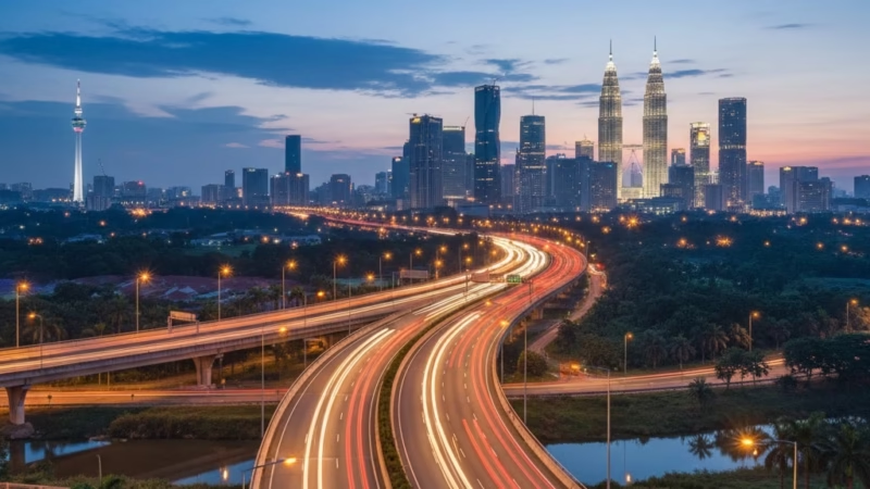
The New Pantai Expressway (NPE), designated as E10, is a major urban expressway in Malaysia that connects Kuala Lumpur’s western suburbs to the southern parts of the Klang Valley. Spanning approximately 19.6 km, the expressway was completed in 2004 and is operated by Metramac Corporation Sdn Bhd. It serves as a vital artery for commuters, commercial traffic, and logistics, easing congestion along the Federal Highway and providing faster access to key southern suburbs and industrial zones.
Route Overview
The NPE runs primarily in a north–south direction, starting from Jalan Subang–Kelana Jaya Interchange in the north and terminating near Pantai Dalam Interchange in the south. It is coded as E10 and functions as an alternative route to the Federal Highway (E1), particularly for commuters heading to Bangsar, Petaling Jaya, and Subang Jaya. Along its route, the expressway traverses bustling urban areas, industrial zones, and residential neighborhoods, providing seamless connectivity across central and western Kuala Lumpur.
Key Cities and Exits
The New Pantai Expressway features several important interchanges and exit points:
- Subang Jaya Interchange – Connects to major residential and commercial hubs.
- PJS Interchange – Provides access to Petaling Jaya and SS2.
- Bangsar Exit – Near popular commercial and nightlife districts.
- Pantai Dalam Interchange – Links to Jalan Klang Lama (Old Klang Road) and other southern suburbs.
- Universiti Malaya Exit – Convenient access to the university campus and surrounding areas.
Each exit connects travelers to key destinations, shopping areas, and feeder roads, making the NPE a crucial urban corridor.
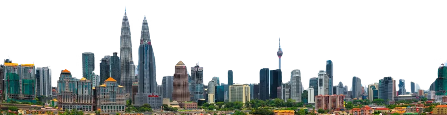
Scenic Highlights
While primarily an urban expressway, the NPE offers glimpses of Kuala Lumpur’s city skyline, landscaped industrial parks, and suburban greenery. Drivers may also enjoy views of urban lakes and reservoirs near Petaling Jaya, as well as landscaped road medians adorned with tropical foliage.
Rest & Service Areas (R&R)
Unlike long-distance highways, the NPE is a short urban expressway and does not feature traditional R&R stops. However, drivers can access various petrol stations, convenience stores, and eateries located near major exits, particularly around Bangsar, PJS, and Subang Jaya, providing essential services like refueling, quick meals, and restrooms.
Toll Information
The New Pantai Expressway operates a closed toll system with multiple toll plazas along its route. Accepted payment methods include:
- Touch ‘n Go
- RFID
- SmartTAG
Sample toll rates for common routes:
| Route | Vehicle Type | Toll (RM) |
|---|---|---|
| Subang Jaya – Pantai Dalam | Car | 3.20 |
| Subang Jaya – Bangsar | Car | 2.00 |
Rates are subject to periodic adjustment by the operator.
Safety & Facilities
The NPE prioritizes commuter safety with:
- 24-hour patrol services and CCTV monitoring.
- Emergency call boxes at select locations.
- Standard speed limits of 80 km/h, with lane signage and dedicated emergency lanes for breakdowns.
- Regular maintenance to ensure smooth traffic flow and minimize accidents.
Useful Apps & Resources
Drivers can use the following tools for real-time updates:
- PLUS Mobile App – Provides traffic conditions and toll info.
- Google Maps & Waze – Real-time navigation and congestion alerts.
- Metramac Corporation Website – Official updates on roadworks and closures.
- Emergency Hotline: 1800-88-9000
Travel Tips
- Travel during off-peak hours to avoid congestion, especially near Petaling Jaya and Bangsar.
- Ensure Touch ‘n Go or RFID cards are topped up for smooth toll payment.
- Observe lane discipline and adhere to speed limits.
- For tourists, plan routes in advance and consider alternative expressways during peak traffic.
Connecting Expressways
The NPE connects seamlessly to several major highways:
- Federal Highway (E1) – via Pantai Dalam Interchange.
- Kesas Expressway (E5) – through Subang Jaya Interchange.
- New Klang Valley Expressway (NKVE, E1) – accessible via connecting feeder roads.
These links make it an essential part of Kuala Lumpur’s broader expressway network.
Summary Table
| Feature | Details |
|---|---|
| Expressway Name | New Pantai Expressway |
| Code | E10 |
| Total Length | 19.6 km |
| Operator | Metramac Corporation Sdn Bhd |
| Start Point | Jalan Subang–Kelana Jaya Interchange |
| End Point | Pantai Dalam Interchange |
| States Covered | Selangor, Kuala Lumpur |
| Average Speed Limit | 80 km/h |
| Toll Type | Closed |
Conclusion
The New Pantai Expressway (NPE) plays a pivotal role in improving urban connectivity, reducing congestion along the Federal Highway, and supporting the economic and logistical needs of the Klang Valley. For daily commuters and commercial drivers alike, the NPE provides a reliable, fast, and well-maintained route that contributes significantly to Malaysia’s urban transport efficiency.
| Road Name | Road Short Name | Code | Main Route |
|---|---|---|---|
| North–South Expressway (PLUS) | North–South Expressway | PLUS / E1, E2 | Bukit Kayu Hitam – Johor Bahru |
| North–South Expressway Central Link | ELITE Expressway | E6 | Shah Alam – Nilai North |
| New Klang Valley Expressway | NKVE | E1 | Kuala Lumpur – Klang |
| Federal Highway | Federal Highway | E5 | Kuala Lumpur – Klang |
| Damansara–Puchong Expressway | LDP | E11 | Damansara – Puchong |
| Shah Alam Expressway | KESAS | E5 | Sri Petaling – Pandamaran |
| New Pantai Expressway | NPE | E10 | Subang – Bangsar |
| Maju Expressway | MEX | E20 | Kuala Lumpur – Putrajaya |
| Kajang Dispersal Link | SILK | E18 | Kajang – Semenyih |
| Kajang–Seremban Highway | LEKAS | E21 | Kajang – Seremban |
| South Klang Valley Expressway | SKVE | E26 | Pulau Indah – Kajang |
| Guthrie Corridor Expressway | GCE | E35 | Shah Alam – Rawang |
| Kuala Lumpur–Karak Expressway | KLK | E8 | Gombak – Karak |
| East Coast Expressway Phase 1 | LPT1 | E8 | Karak – Kuantan |
| East Coast Expressway Phase 2 | LPT2 | E8 | Kuantan – Kuala Nerus |
| Butterworth–Kulim Expressway | BKE | E15 | Butterworth – Kulim |
| Penang Bridge | Penang Bridge | E36 | Gelugor – Perai |
| Sultan Abdul Halim Muadzam Shah Bridge | Second Penang Bridge | E28 | Batu Maung – Batu Kawan |
| Johor Bahru Eastern Dispersal Link | EDL | E14 | Pandan – CIQ Johor |
| Senai–Desaru Expressway | SDE | E22 | Senai – Desaru |
| Second Link Expressway | Linkedua | E3 | Senai – Tuas (Singapore) |
| Kuala Lumpur–Seremban Expressway | KL–Seremban | E37 | Kuala Lumpur – Seremban |
| Cheras–Kajang Expressway | Grand Saga | E7 | Cheras – Kajang |
| Kuala Lumpur–Putrajaya Expressway | MEX | E20 | KL – Putrajaya – KLIA |
| West Coast Expressway | WCE | E32 | Taiping – Banting |
| Central Spine Road | CSR | – | Bentong – Kuala Krai |
| Federal Route 1 | Federal Route 1 | FT1 | Bukit Kayu Hitam – Johor Bahru |
| Federal Route 2 | Federal Route 2 | FT2 | Port Klang – Kuantan |
| Federal Route 3 | Federal Route 3 | FT3 | Johor Bahru – Rantau Panjang |
| Federal Route 4 | Federal Route 4 | FT4 | Gerik – Jeli |
| Federal Route 5 | Federal Route 5 | FT5 | Ipoh – Johor Bahru |
| Federal Route 8 | Federal Route 8 | FT8 | Kuala Lumpur – Kota Bharu |
| Federal Route 9 | Federal Route 9 | FT9 | Karak – Tampin |
| Federal Route 10 | Federal Route 10 | FT10 | Temerloh – Gemas |
| Federal Route 24 | Federal Route 24 | FT24 | Muar – Yong Peng |
| Federal Route 50 | Federal Route 50 | FT50 | Batu Pahat – Kluang – Jemaluang |
| Federal Route 51 | Federal Route 51 | FT51 | Melaka City – Alor Gajah |
| Federal Route 54 | Federal Route 54 | FT54 | Kuala Lumpur – Kuala Selangor |
| Federal Route 76 | Federal Route 76 | FT76 | Kuala Kangsar – Baling – Kulim |
| Federal Route 67 | Federal Route 67 | FT67 | Sungai Petani – Kuala Ketil |
| Pan Borneo Highway (Sabah) | Pan Borneo Sabah | AH150 / PBHS | Kota Kinabalu – Tawau |
| Kimanis–Keningau Highway | Kimanis–Keningau Road | – | Kimanis – Keningau |
| Kota Belud–Ranau Road | Kota Belud–Ranau | – | Coastal – Interior link |
| Pan Borneo Highway (Sarawak) | Pan Borneo Sarawak | AH150 / PBHS | Telok Melano – Miri |
| Kuching–Serian Road | Kuching–Serian | – | Kuching – Serian |
| Bintulu–Miri Coastal Road | Bintulu–Miri Coastal | – | Bintulu – Miri |
| Kota Bharu–Kuala Krai Expressway | KBKK Expressway | KBKK | Kota Bharu – Kuala Krai |
| Pan Borneo Highway (Overall) | Pan Borneo Highway | PBH | Across Sabah & Sarawak |


Comments are closed.