Guthrie Corridor Expressway (GCE)
Overview
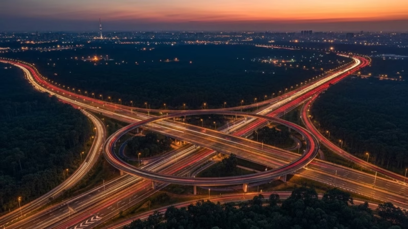
The Guthrie Corridor Expressway (GCE) is a strategic expressway in Malaysia that connects the North–South Expressway (E1) near Shah Alam to the town of Rawang in Selangor. Spanning approximately 25 km, it was completed in 2005 and is operated by GCE Holdings Sdn Bhd. Serving as a key route for commuters and logistics, the GCE eases traffic congestion on the Federal Highway and provides a faster alternative for vehicles traveling between Klang Valley and northern Selangor towns. This expressway is vital for trade, daily commuting, and regional connectivity.
Route Overview
The Guthrie Corridor Expressway runs in a north–south direction, starting from Kota Damansara Interchange and ending at Rawang South Interchange. The expressway is officially coded as E35 and passes through several major townships and industrial areas, making it an essential artery for both commercial and private vehicles. Key milestones along the route include Shah Alam, Bukit Jelutong, and Sungai Buloh, connecting seamlessly to other major expressways like the North–South Expressway (E1) and the North Klang Valley Expressway (NKVE, E1).
Key Cities and Exits
Along the GCE, drivers can access multiple towns and interchanges:
- Kota Damansara Interchange – connects to Sprint Expressway (E23)
- Bukit Jelutong Interchange – serves industrial zones and residential areas
- Sungai Buloh Interchange – links to Kuala Lumpur MRT stations and local towns
- Rawang South Interchange – connects to North–South Expressway (E1)
These exits provide convenient access to commercial hubs, industrial parks, and residential townships along the GCE corridor.
Scenic Highlights
While primarily a commuter expressway, the GCE offers some scenic views, particularly around Bukit Jelutong and Rawang, where lush greenery, oil palm plantations, and low-density residential landscapes can be seen. Drivers traveling early in the morning or late evening can enjoy the serene greenery of Selangor without the heavy urban traffic of central Kuala Lumpur.
Rest & Service Areas (R&R)
The Guthrie Corridor Expressway is relatively short, so it does not have large-scale R&R stops like longer Malaysian expressways. However, several fuel stations and small service areas are accessible near interchanges, offering:
- Petrol stations (Petron, Shell)
- Convenience stores
- Prayer rooms (surau)
- Restrooms
For longer journeys, drivers can plan stops at nearby R&R areas along the North–South Expressway (E1).
Toll Information
The GCE operates on an open toll system, with toll plazas located at main entry and exit points. Accepted payment methods include:
- Touch ‘n Go
- SmartTAG
- RFID
Sample toll rates (as of 2025):
- Kota Damansara – Rawang: RM5.40 for private vehicles
Toll rates are subject to change; drivers should check official sources before traveling.
Safety & Facilities
The GCE prioritizes driver safety with the following features:
- Regular patrols by GCE Ronda for emergency assistance
- Standard speed limits of 90 km/h
- Multiple lanes in each direction, with emergency breakdown lanes
- CCTV surveillance and traffic monitoring systems
- Emergency hotlines for accidents or vehicle breakdowns
Useful Apps & Resources
For real-time updates and navigation, the following tools are recommended:
- GCE official website – toll rates, announcements, and road conditions
- PLUS Expressways Mobile App – live traffic monitoring
- Waze / Google Maps – navigation with traffic updates
- Touch ‘n Go eWallet – toll payment
Travel Tips
- Travel outside peak hours (7–9 AM and 5–7 PM) to avoid congestion near Kota Damansara and Sungai Buloh.
- Keep Touch ‘n Go or RFID ready for faster toll transactions.
- Maintain lane discipline and adhere to posted speed limits.
- Plan stops for fuel or rest before entering longer stretches, as dedicated R&R is limited.
Connecting Expressways
The GCE provides seamless connectivity to several major expressways:
- North–South Expressway (E1) – via Rawang South Interchange
- North Klang Valley Expressway (NKVE, E1) – via Bukit Jelutong
- Sprint Expressway (E23) – via Kota Damansara Interchange
These connections make it a critical route for commuters and logistics moving within the Klang Valley region.
Summary Table
| Feature | Details |
|---|---|
| Expressway Name | Guthrie Corridor Expressway |
| Code | E35 |
| Total Length | 25 km |
| Operator | GCE Holdings Sdn Bhd |
| Start & End Points | Kota Damansara – Rawang South |
| States Covered | Selangor |
| Average Speed Limit | 90 km/h |
| Toll Type | Open |
Conclusion
The Guthrie Corridor Expressway (GCE) is a vital part of Malaysia’s expressway network, improving connectivity between Klang Valley and northern Selangor towns. By easing congestion on other major routes and providing a faster alternative for commuters and logistics, the GCE plays a significant role in both travel efficiency and regional economic growth. Whether for daily commuters or long-distance travelers, the GCE continues to be an essential corridor for smooth and safe journeys across Selangor.
| Road Name | Road Short Name | Code | Main Route |
|---|---|---|---|
| North–South Expressway (PLUS) | North–South Expressway | PLUS / E1, E2 | Bukit Kayu Hitam – Johor Bahru |
| North–South Expressway Central Link | ELITE Expressway | E6 | Shah Alam – Nilai North |
| New Klang Valley Expressway | NKVE | E1 | Kuala Lumpur – Klang |
| Federal Highway | Federal Highway | E5 | Kuala Lumpur – Klang |
| Damansara–Puchong Expressway | LDP | E11 | Damansara – Puchong |
| Shah Alam Expressway | KESAS | E5 | Sri Petaling – Pandamaran |
| New Pantai Expressway | NPE | E10 | Subang – Bangsar |
| Maju Expressway | MEX | E20 | Kuala Lumpur – Putrajaya |
| Kajang Dispersal Link | SILK | E18 | Kajang – Semenyih |
| Kajang–Seremban Highway | LEKAS | E21 | Kajang – Seremban |
| South Klang Valley Expressway | SKVE | E26 | Pulau Indah – Kajang |
| Guthrie Corridor Expressway | GCE | E35 | Shah Alam – Rawang |
| Kuala Lumpur–Karak Expressway | KLK | E8 | Gombak – Karak |
| East Coast Expressway Phase 1 | LPT1 | E8 | Karak – Kuantan |
| East Coast Expressway Phase 2 | LPT2 | E8 | Kuantan – Kuala Nerus |
| Butterworth–Kulim Expressway | BKE | E15 | Butterworth – Kulim |
| Penang Bridge | Penang Bridge | E36 | Gelugor – Perai |
| Sultan Abdul Halim Muadzam Shah Bridge | Second Penang Bridge | E28 | Batu Maung – Batu Kawan |
| Johor Bahru Eastern Dispersal Link | EDL | E14 | Pandan – CIQ Johor |
| Senai–Desaru Expressway | SDE | E22 | Senai – Desaru |
| Second Link Expressway | Linkedua | E3 | Senai – Tuas (Singapore) |
| Kuala Lumpur–Seremban Expressway | KL–Seremban | E37 | Kuala Lumpur – Seremban |
| Cheras–Kajang Expressway | Grand Saga | E7 | Cheras – Kajang |
| Kuala Lumpur–Putrajaya Expressway | MEX | E20 | KL – Putrajaya – KLIA |
| West Coast Expressway | WCE | E32 | Taiping – Banting |
| Central Spine Road | CSR | – | Bentong – Kuala Krai |
| Federal Route 1 | Federal Route 1 | FT1 | Bukit Kayu Hitam – Johor Bahru |
| Federal Route 2 | Federal Route 2 | FT2 | Port Klang – Kuantan |
| Federal Route 3 | Federal Route 3 | FT3 | Johor Bahru – Rantau Panjang |
| Federal Route 4 | Federal Route 4 | FT4 | Gerik – Jeli |
| Federal Route 5 | Federal Route 5 | FT5 | Ipoh – Johor Bahru |
| Federal Route 8 | Federal Route 8 | FT8 | Kuala Lumpur – Kota Bharu |
| Federal Route 9 | Federal Route 9 | FT9 | Karak – Tampin |
| Federal Route 10 | Federal Route 10 | FT10 | Temerloh – Gemas |
| Federal Route 24 | Federal Route 24 | FT24 | Muar – Yong Peng |
| Federal Route 50 | Federal Route 50 | FT50 | Batu Pahat – Kluang – Jemaluang |
| Federal Route 51 | Federal Route 51 | FT51 | Melaka City – Alor Gajah |
| Federal Route 54 | Federal Route 54 | FT54 | Kuala Lumpur – Kuala Selangor |
| Federal Route 76 | Federal Route 76 | FT76 | Kuala Kangsar – Baling – Kulim |
| Federal Route 67 | Federal Route 67 | FT67 | Sungai Petani – Kuala Ketil |
| Pan Borneo Highway (Sabah) | Pan Borneo Sabah | AH150 / PBHS | Kota Kinabalu – Tawau |
| Kimanis–Keningau Highway | Kimanis–Keningau Road | – | Kimanis – Keningau |
| Kota Belud–Ranau Road | Kota Belud–Ranau | – | Coastal – Interior link |
| Pan Borneo Highway (Sarawak) | Pan Borneo Sarawak | AH150 / PBHS | Telok Melano – Miri |
| Kuching–Serian Road | Kuching–Serian | – | Kuching – Serian |
| Bintulu–Miri Coastal Road | Bintulu–Miri Coastal | – | Bintulu – Miri |
| Kota Bharu–Kuala Krai Expressway | KBKK Expressway | KBKK | Kota Bharu – Kuala Krai |
| Pan Borneo Highway (Overall) | Pan Borneo Highway | PBH | Across Sabah & Sarawak |


Comments are closed.